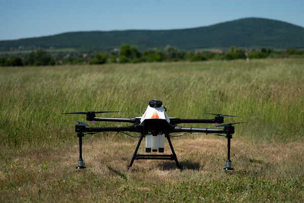
Quantum Solutions Launches Real-Time Water Mapping Drone Payload
At the SPIE Future Sensing Technologies conference, Quantum Solutions introduced Q.Fly Water, a drone payload that maps surface moisture in real time using advanced quantum-dot technology, enhancing precision in various applications including agriculture and environmental monitoring.
Key facts
- Q.Fly Water offers real-time surface moisture mapping with centimetre precision.
- The payload computes NDMI onboard, providing instant data visualization.
- Applications include precision agriculture, wetland monitoring, and infrastructure inspection.
2 minute read
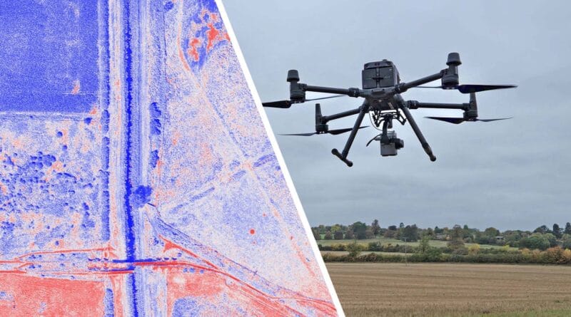
Quantum Solutions' Q.Fly Water points to a maturing class of edge sensing tools that Europe needs as climate volatility strains agriculture, infrastructure and emergency response. By calculating NDMI onboard and rendering moisture maps on the controller, the payload closes the latency gap that dogs satellite products. For European operators this means faster flood reconnaissance, better irrigation control and more precise monitoring of wetlands that underpin EU environmental compliance.
For defence and civil protection, real time moisture awareness is a mobility and survivability advantage. Engineers can assess trafficability, soil saturation and water pooling on runways or dispersal sites before moving heavy assets. Commanders gain timely ground truth without bandwidth-heavy downlinks, which is valuable when connectivity is constrained. The compact 600 gram form factor and compatibility with DJI Matrice simplifies deployment across existing public safety fleets, though reliance on DJI platforms may complicate adoption in jurisdictions that restrict Chinese airframes.
The technology is developed in the UK, reinforcing a European sensor supply base in shortwave infrared imaging. The next step is integration, common data formats and APIs so outputs feed GIS, C2 and digital twin tools used by NATO and national agencies. Clear procurement pathways, cyber assurance and data governance will determine whether dual use products like Q.Fly Water cross the civil military divide at scale. As member states expand climate resilience budgets, cost effective edge analytics that bridge satellite imagery and in situ sensors will gain priority.
Europe's defence ecosystem is converging on faster sensing, tighter loops and resilient edge autonomy.