Skeyetech drones deployed for MISO Arctic methane monitoring
Azur Drones deployed its Skeyetech autonomous drone system across three field campaigns for the EU MISO project to map methane and CO2 in wetlands and the Arctic.

Key facts
- Skeyetech adapted with NDIR methane sensors (Senseair K96 and NILU LCS2) and validated in flight.
- Three-phase campaign: Bordeaux tests, Hyytiälä wetland month, and Svalbard Arctic deployment.
- LoRa low-power long-range comms used; drone also served as mobile data relay in remote areas.
3 minute read
Drones vs. Climate Change: Monitoring Methane in the Arctic
In 2025, the fight against climate change took a high-tech turn in the frozen landscapes of the Arctic. Azur Drones, known for their autonomous surveillance systems, deployed their "Skeyetech" drone to some of the most remote environments on Earth.
Part of the European MISO (Multi-scale In Situ Observation) project, this mission focused on a critical piece of the climate puzzle: methane emissions from thawing permafrost.
The MISO Mission: Why Methane Matters
Coordinated by the Norwegian Institute for Air Research (NILU), the MISO project aims to bridge the gap between satellite data and ground-level reality. While satellites can track greenhouse gases from space, they require reliable data from the ground to verify their accuracy.
This is particularly urgent in Arctic regions and wetlands. As permafrost thaws, it releases methane (CH₄) and carbon dioxide (CO₂), creating a feedback loop that accelerates global warming. Capturing this data, however, requires working in areas that are dangerous or difficult for humans to access.
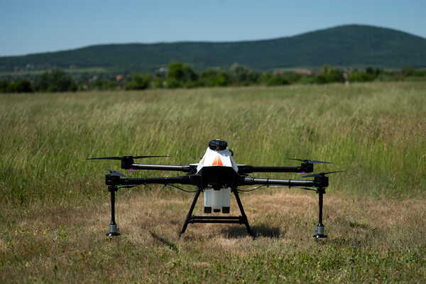
Skeyetech: From Security to Science
The star of this operation was Skeyetech, an autonomous "drone-in-a-box" solution. Originally designed for security and surveillance, the system was retrofitted for science. Engineers integrated sensitive gas sensors (based on Non-Dispersive Infrared technology) and long-range LoRa communication systems capable of transmitting data without standard infrastructure.
The drone station is a beast of engineering, weighing over 400 kg and designed to protect the drone in extreme climates. It includes a climate control system that allows operations in temperatures ranging from -15°C to +50°C.
A Journey in Three Phases
The deployment didn't happen overnight. It was a year-long logistical marathon divided into three key stages:
1. The Warm-Up (France, Nov 2024) Before heading north, the team tested the system near Bordeaux. They equipped the drone with NILU and Senseair gas sensors, using artificial methane sources to prove the drone could detect gas leaks autonomously while flying.
2. The Wetlands Test (Finland, Sept 2025) The team moved to the Hyytiälä forestry research station in Finland. Here, they measured methane in a real-world wetland environment. This phase was crucial for comparing drone data against established ground sensors, validating that the flying laboratory was just as accurate as stationary tools.
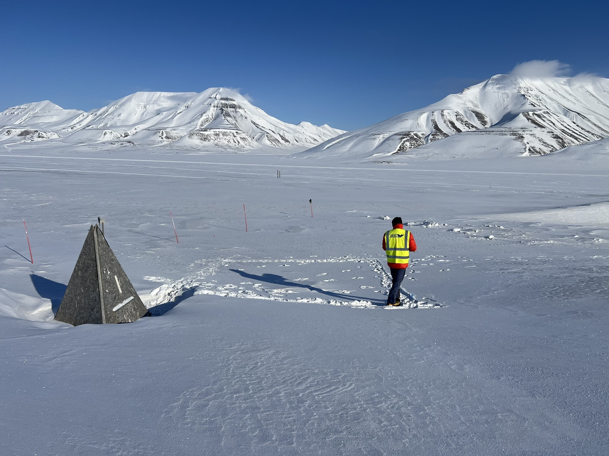
3. The Arctic Challenge (Svalbard, Oct 2025) The final phase took place in Svalbard, deep in the Arctic. Operating in temperatures as low as -5°C (with a wind chill near -15°C), the drone mapped methane and CO₂ concentrations over permafrost. This phase was a massive logistical success, proving that autonomous robots can support climate scientists in the harshest conditions on the planet.
The Future of Climate Monitoring
This mission highlights a "Drone for Good" approach. By combining ground sensors, satellite data, and autonomous aerial platforms, scientists can now get a complete picture of how our planet is breathing.
The success of the 2025 campaign proves that technology can do more than just observe; it can go where humans cannot, providing the essential data needed to understand and combat climate dynamics.
Source: Azur Drones